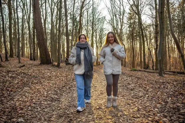
Car-Free Adventures on the Sussex Chalk Ridge

Today we’re exploring Car-Free Sussex Chalk Ridge Walks, celebrating the sweeping South Downs where chalk grassland, skylarks, and cliff-top paths meet hassle-free trains and buses. Leave the car behind, step straight from station platforms onto ancient ridgeways, and wander between villages, vineyards, and sea views. Expect practical transport tips, soulful stories, and route ideas shaped by wind, light, and history, plus friendly invitations to share your own discoveries, photos, and shortcuts for making every journey lighter on the planet and richer for the senses.

Arrive with Ease: Trains and Buses to the Downs

Reaching the ridge is simple when wheels on rails and frequent buses replace parking stress. Coastal lines bring you beside glittering seas, while inland halts step you almost directly onto chalk paths. Services connect Brighton, Lewes, Seaford, Eastbourne, Arundel, and more, with seasonal routes climbing toward Devil’s Dyke and Ditchling Beacon. Plan around off-peak fares, contactless capping, and real-time apps, and you’ll discover how spontaneity thrives when timetables become gentle companions rather than rigid rulers.

Seaford to Eastbourne via the Seven Sisters

A classic coastal epic, this clifftop traverse marries train-to-train convenience with unforgettable drama. Roll in at Seaford, climb to Seaford Head, and breathe where chalk meets sea spray. Undulating cliffs fold into the Cuckmere, then lift again toward Birling Gap and Beachy Head. Bailout options include buses at Exceat or Birling Gap, but pressing onward to Eastbourne grants a triumphant station finish. Watch for strong winds, stay well behind edges, and treat every white crest like a fragile sculpture.

Southease to Lewes over Mount Caburn

Southease station sits almost on the South Downs Way, inviting a morning amble beside the River Ouse before climbing past Glynde toward Mount Caburn’s commanding crown. Chalk paths glow, orchids surprise in season, and larks fuse sound with sky. Choose a Glynde detour for tea, or crest Caburn and descend to historic Lewes, where Harveys drifts from brewery to pub. The route is flexible, the views panoramic, and trains from Both ends keep logistics as gentle as the downland contours.

Amberley to Arundel along the Arun Escarpment

Step from Amberley’s platform and you’re practically at the South Downs Way. The trail rides high over the river valley, curving through turf bright with chalkland flowers. Waymarks ease decisions, while side paths drop toward welcoming villages. End in Arundel beneath the castle’s watchful turrets, where trains glide you home. On breezy days the ridge hums like a taut string, and every turn reveals another sweep of pasture, oak, and flint, finishing with twilight glints along the Arun.

Butterflies on Bright, Blue-Wing Days

Adonis blue and chalkhill blue butterflies turn chalk meadows electric from late spring through high summer. Horseshoe vetch feeds their larvae, so flowering patches become pocket universes of color and rhythm. Marbled whites dance through July breezes, while small heaths skitter low along warm turf. Bring patience, a gentle gaze, and a willingness to pause. By lingering, you become part of the meadow’s calm, and the living mosaic reveals itself wing by wing, flower by flower.

Flora of Thin Soils and Old Traditions

Bee orchids mimic their pollinators with playful masks, while pyramidal orchids punctuate slopes with vivid pink spires. Cowslips ring in spring like jubilant bells, and thyme releases scent under careful boots. These plants persist thanks to centuries of grazing and thoughtful stewardship. Notice dewponds reflecting clouds, sometimes visited by newts, birds, and thirsty walkers alike. When scrub pushes forward, diversity recedes, reminding us that conservation is a verb, constantly renewed by choices made on gates, paths, and pastures.

Maps, Apps, and Waymarks That Guide

The South Downs Way wears the National Trail acorn, pointing decisions in simple, reassuring ways. OS Explorer maps OL11 and OL10 capture detail beyond phone screens, and offline app layers shine when signal fades. Waypoints help estimate water and bailout points, while What3words provides precise references for emergencies. Note that chalk tracks can braid and split; cross-check with contours, gates, and field edges. The more familiar you become with signs, the freer your feet and thoughts will feel.

Weather, Water, and the Grip of Chalk

Dry chalk is friendly and springy; wet chalk can become glassy and treacherous. Traction matters, so choose soles with bite and take measured steps on steeper pitches. Wind whips faster on ridgelines, demanding layers and secure hats. Shade is scarce, making sunscreen and steady sipping essential. Identify village taps, cafés, or known water points before you set off. By pacing ambition to daylight and carrying simple safeguards, you turn uncertainty into attentiveness, and attentiveness into deep, grounded enjoyment.

Respectful Walking and the Countryside Code

Close gates carefully, even when a view tempts you to forget. Give livestock room, pass wide, and keep dogs close during lambing and ground-nesting bird seasons. Pack out litter, including fruit peels that linger surprisingly long. Avoid fires on tinder-dry turf, and step around fragile verges where orchids and vetch anchor life. Greet fellow walkers, cyclists, and riders; cooperation keeps shared paths harmonious. Your small courtesies echo through habitats and communities, ensuring these ridges remain generous for everyone.

Walk Smart on White Hills

Chalk welcomes sunlight yet turns tricky in rain, so wise preparation transforms a good day into a great one. Carry enough water, because taps are scarce along high ground and wind dries faster than you expect. Pack layers, sun protection, and a steady tread. Download offline maps, carry a paper backup, and learn waymarks. With flexible goals, generous margins, and respect for changing skies, you’ll harvest confidence from the ridge while leaving only light impressions on its patient paths.

Pubs, Picnics, and Downsland Delights

Village Treats and Station Bites

Lewes greets tired legs with independent cafés and the gentle clink of Harveys glasses in historic pubs. Hassocks has speedy grab-and-go options for ridgebound walkers, while Amberley and Arundel reward effort with comforting fare near castle shadows and river bends. Stock up before steep climbs, since shops thin out aloft. A thoughtfully timed coffee or bakery stop can transform morale, turning grey moments golden and giving your map plans renewed sparkle as horizons open again.

Vineyards and Views Worth Lingering Over

Ridgeview near Ditchling and Rathfinny above the Cuckmere valley remind you that chalk nurtures more than wildflowers. Slopes cradle vines that translate light and soil into bottles filled with celebration. Always check opening times, booking requirements, and walking access, and keep tastings modest when miles remain. Even if you only pause to admire neat rows against sky, that moment connects agriculture, geology, and your footsteps into a single, quietly joyful conversation carried by the wind.

Coast-to-Downs Refreshments

Birling Gap’s clifftop café shelters walkers when winds rise and gulls scrawl grey letters across the day. Seaford’s kiosks brighten beach finishes with tea or ice cream, while the Beachy Head Inn feels like a hearth on the edge of the world. Check seasonal hours, carry a backup snack, and avoid cliff-edge picnics in gusty weather. By eating slightly inland, you gain calm, warmth, and the chance to notice butterflies looping above thyme-scented turf with companionable nonchalance.

Share the Path, Grow the Journey

Walking without a car is a community act: lighter on lanes, kinder to villages, and friendlier to the air we breathe. These ridges feel richer when stories circulate between footsteps, timetables, and waymarks. Send route tweaks, bus hacks, and station shortcuts; teach others how to bail out gracefully or stretch into golden-hour views. Subscribe for new itineraries, comment with recent trail conditions, and tag your photos so we can cheer your discoveries. Together, we keep the chalk bright.
Not every glorious view requires steep climbs. Devil’s Dyke offers big-sky circuits with flexible lengths, while Ditchling Beacon provides short, rewarding ambles along the crest. Seek step-free stations, gentler gradients, and firmer surfaces where possible. Families can enjoy prom-to-downs combinations, weaving playgrounds or beaches into ridge explorations. Share accessibility notes, stile counts, and gate conditions, because small details help others decide with confidence. When more people feel welcomed, the ridge’s chorus of footsteps grows warmer and more varied.
Car-free freedom thrives on flexibility. Build simple backup plans in case a bus is full, a shower sweeps in, or energy dips. Travel in small groups, agree on turning points, and keep an eye on daylight. Off-peak fares and railcards stretch budgets, while live updates prevent awkward surprises. Carry a power bank, whistle, and an extra layer, then celebrate spontaneous detours that lead to better views, unexpected skylarks, or an unplanned bakery with just-baked magic unfolding behind steamy windows.
Zentopirakiratari
Privacy Overview

This website uses cookies so that we can provide you with the best user experience possible. Cookie information is stored in your browser and performs functions such as recognising you when you return to our website and helping our team to understand which sections of the website you find most interesting and useful.